Distant Quakes Reveal Hidden Fault Shapes That Alter California Shake Risk
A new study of the magnitude 7.7 earthquake that occurred near Mandalay, Myanmar, on March 28, 2025, has provided critical data to model shaking on the San Andreas Fault in California. These findings suggest that the geometry of a fault line significantly affects the strength and distribution of seismic waves, offering scientists a more accurate way to assess risk for a possible major earthquake along the state’s famous boundary.
Sagaing Fault Geometry Mirrors California Risks
The Myanmar earthquake tremors were felt in Bangkok, located about 1,330 kilometers away, and at least 3,700 people were killed in the region. Researchers analyzed detailed satellite data and a surveillance camera recording that captured the ground rupturing during the fault’s movement to understand how energy propagates through different structural shapes.
Modeling showed that the Sagaing Fault is not a vertical plane underground. In its northern section, the fault surface slopes westward; in the central section, it is vertical; and in the southern section, it slopes eastward. According to Alice-Agnes Gabriel, a geophysicist at the Scripps Institution of Oceanography at the University of California, San Diego, stronger shaking usually occurs in the direction of the fault’s dip.
The Sagaing Fault shares features with other strike-slip faults near populated areas, including the San Andreas. California’s fault also dips inland, toward California’s high desert. If a possible major earthquake on the San Andreas develops similarly to the event in Myanmar, stronger shaking may occur on its inland, less populated side rather than in coastal areas.
Historical Data Predicts Rupture Characteristics
Scientists also found that individual segments of the Sagaing Fault had been locked and accumulating stress for 186 years before rupturing. Using data available before the earthquake, the team was able to predict the trajectory, shape and speed of the rupture’s propagation.
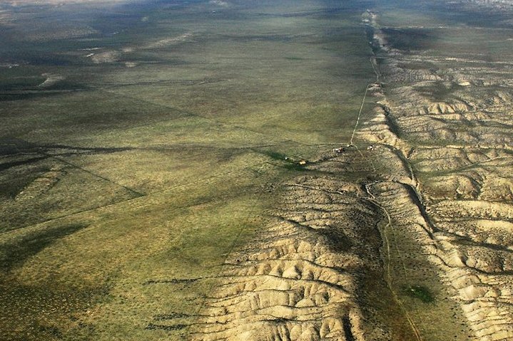
Geologist Andrew Lawson identified the San Andreas Fault in 1895 by mapping offsets from surface ruptures following the 1906 San Francisco earthquake. He began by surveying and mapping offsets such as fences or roads that had been sliced in half along surface ruptures. When the location of these offsets were plotted on a map, he noted that they made a near perfect line on top of the fault he previously discovered.
The San Andreas Fault extends roughly 750 miles through California as part of the boundary between the Pacific and North American plates. Traditionally, for scientific purposes, the fault has been classified into three main segments, each with different characteristics and a different degree of earthquake risk. The average slip rate along the entire fault ranges from 0.79 to 1.38 inches per year.
A National Science Foundation funded project called the San Andreas Fault Observatory at Depth near Parkfield, California, involved drilling through the fault from 2004 to 2007 to collect core samples and make direct geophysical and geochemical observations to better understand fault behavior at depth. Gabriel stressed that it is impossible to predict the exact time and location of an earthquake, but long-term observations of faults can help forecast certain characteristics of such events.
Updated Models Guide Infrastructure and Safety
Researchers are working to update the model of a possible major earthquake on the San Andreas. The results are planned to be used to prepare the population, inform building codes and support the work of emergency response services in California. This approach aligns with research using UC San Diego’s shake table, which is one of the largest in the world and has helped design and build safer and more resilient infrastructure.
The UC San Diego shake table has accelerated the discovery of the knowledge engineers need to design safer new buildings, bridges, power plants, dams, levees, telecommunication towers, wind turbines, retaining walls, tunnels, and to retrofit existing structures vulnerable to earthquakes. Joel Conte, a professor in the Department of Structural Engineering and one of the co-principal investigators at the shake table, noted that ultimately, it contributes to making our communities safer and more resilient.
While the risk of an earthquake happening in California is high, take comfort in knowing we’re safer from earthquakes thanks to research using UC San Diego’s shake table. Research like this is absolutely critical to protecting lives, but it’s also important for everyone to actually prepare for earthquakes.
Community Readiness and Early Warning Systems
Simple actions like practicing Drop, Cover, and Hold On or creating a Go Bag are critical for earthquake readiness. One way to do this is by participating in the Great California Shakeout Drill happening on campus today, October 15, at 10:15 a.m. As part of the exercise, you can practice “Drop, Cover and Hold On” – the recommended protective action to take during an earthquake.
You can also stop by the Great ShakeOut and Gear Up event where you can learn lifesaving skills, connect with emergency management staff and find tools and resources to help you prepare for emergencies. Julie Jeakle, director of Emergency Management and Preparedness, encouraged everyone to stop by the Great Shakeout event and take advantage of the resources available.
Key steps to take to help you become more earthquake-ready include creating a “Go Bag” with essential supplies including food, water, medicine and personal hygiene items. You can also assess your space to consider how you could improve safety by securing objects that might fall, overturn or slide during shaking.
Develop or update your department Emergency Action Plan. These plans are integral to campuswide emergency preparedness with many procedures in the UC San Diego Emergency Guide dependent on departments following their Emergency Action Plan. Sign-up to receive emergency notifications and alerts. Your UC San Diego email account is already registered to receive Triton Alert notifications but you must add your phone number if you want to receive SMS.
You can also download the free MyShake app – the statewide warning system that could give California residents crucial seconds to take cover before you feel shaking. For more information on how to prepare for an earthquake or other emergencies, contact the Emergency Management Team at [email protected].
Sources
- Myanmar quake study helps model San Andreas shaking — Live Science
- San Andreas Fault
- Are You Prepared for an Earthquake?
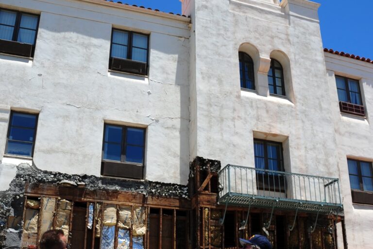
Photo: John Wiley User:Jw4nvc – Santa Barbara, California (CC BY 3.0)