The record begins with a correction. TIROS-1, the first weather satellite, lifted off from Cape Canaveral at 6:40 EST on April 1, 1960, and the frame long circulated as its inaugural picture, a grainy view centered on Maine and the Canadian Maritime provinces, was in fact shot at 1608 UTC on April 2, according to a later accounting on the CIMSS satellite blog. The true “first image”, the record shows, was captured at 1331 UTC on launch day itself, a distinction lost until the archive was rechecked. TIROS-1 operated for only 78 days. That was enough to change forecasting.
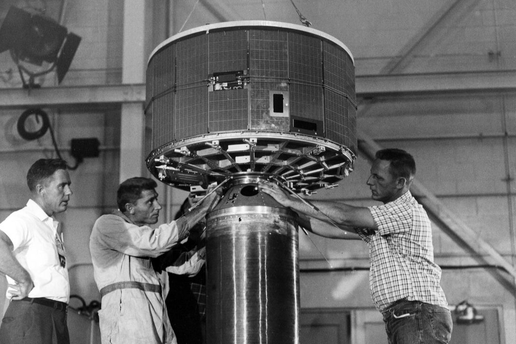
TIROS stood for Television Infrared Observation Satellite, and the program was a consortium: NASA flew it with RCA, the Army Signal Research and Development Laboratory, the U.S. Weather Bureau and the Naval Photographic Interpretation Center. The craft weighed two hundred and seventy pounds, an aluminum alloy and stainless steel drum carrying nine thousand two hundred solar cells and two television cameras. One of those cameras returned the initial pictures of Earth from orbit, and on April 10, 1960, the satellite produced the first orbital picture of a tropical cyclone, taken over the South Pacific. Successors followed on the timeline: Tiros 2 went up November 23, 1960 and lasted three hundred and seventy-six days in service; Tiros 3 followed on July 12, 1961 for two hundred and thirty days more; then Tiros 4 from February 8, 1962, one hundred and sixty-one days. From 1962 the series gave meteorology continuous coverage of the planet’s weather, and improved versions kept flying through 1967.
Navigation was the second front, and it opened twelve days after TIROS. Transit 1-b, the second navigation prototype, reached orbit after Transit 1-A had failed to get there on September 17, 1959. The concept was born of Sputnik: after the 1957 surprise, William Guier and George Weiffenbach, physicists at the Johns Hopkins Applied Physics Laboratory, studied the doppler shift of satellite signals, and with Richard Kershner and Frank McClure, plus the Navy and what was then the Defense Advanced Research Projects Agency, work on a positioning system began in 1958. The Navy tested Transit from 1960 through 1963 and made it operational in 1964; the 1960 flight also proved an engine could be restarted in space. Between 1967 and 1991, thousands of navy and commercial vessels steered by Transit, out of forty-one satellites ultimately flown under the name, a working constellation of six, three active and three spares. The doppler lineage running through that system is the acknowledged ancestor of GPS.
The modern measuring stick came in 2013, when the CIMSS blog marked the anniversary of that first transmission by pairing the TIROS frame with same-region imagery from Suomi NPP’s VIIRS Day/Night Band. Under a waning gibbous moon at 67% of full illumination, the instrument delivered what the researchers called a “visible image at night”: sea ice mapped in the channels between New Brunswick, Prince Edward Island and Nova Scotia, banded wave clouds riding an undular bore off the Nova Scotia coast, and the cloud-top brightness of overshooting tops in storms off Maine. The comparison is the whole story in one frame. The manned race took the headlines, then and since; the durable legacy of 1960 was quieter, a weather eye that made forecasting global and a navigation experiment whose descendant, GPS, now positions the world. On the timeline, that is the trade the space race actually delivered.
Sources
- 53rd anniversary of the first image from a meteorological satellite — CIMSS Satellite Blog, CIMSS
- 1960 Detail, First Weather Satellite Launched, America's Best History U.S. Timeline, 1960-1969