An automated monitoring network in Haiti reported a magnitude 5.2 earthquake in the Bahamas late Wednesday, but the event did not trigger a tsunami warning for the U.S. East Coast because major international catalogs had not confirmed it and the data did not meet alert thresholds.
Discrepancy Between Monitoring Networks
The quake was detected by Ayiti-Séismes, a real-time system run by scientists in Haiti and France, which placed the origin time at 05:07:22 UTC on Thursday, Nov. 19. The network located the epicenter at 26.55 degrees north and 77.74 degrees west, over the shallow Little Bahama Bank, about 60 miles east of Freeport and 107 miles north of Nassau. As of Thursday morning, the event had not appeared in the catalogs of the U.S. Geological Survey, the European-Mediterranean Seismological Centre, or Germany’s GFZ Helmholtz Centre for Geosciences. The USGS National Earthquake Information Center routinely locates quakes of magnitude 4.5 and larger worldwide, but its catalog showed no event within roughly 500 miles of the reported epicenter since midday Wednesday.
How Automated Depth Defaults Affect Tsunami Calculations
The monitoring system assigned a depth of 5 kilometers to the event. Automated systems often use 5 kilometers as a default when depth is poorly constrained. That default matters for tsunami potential: shallow quakes can displace more water, but the uncertainty around the depth estimate meant the data could not be relied upon for hazard modeling. VolcanoDiscovery, a private site that aggregates agency reports, listed the quake’s status as unconfirmed and noted it was uncertain whether an earthquake with these data happened. Ayiti-Séismes was the only agency listed in the site’s comparison table as of Thursday morning.
Geography and the Little Bahama Bank
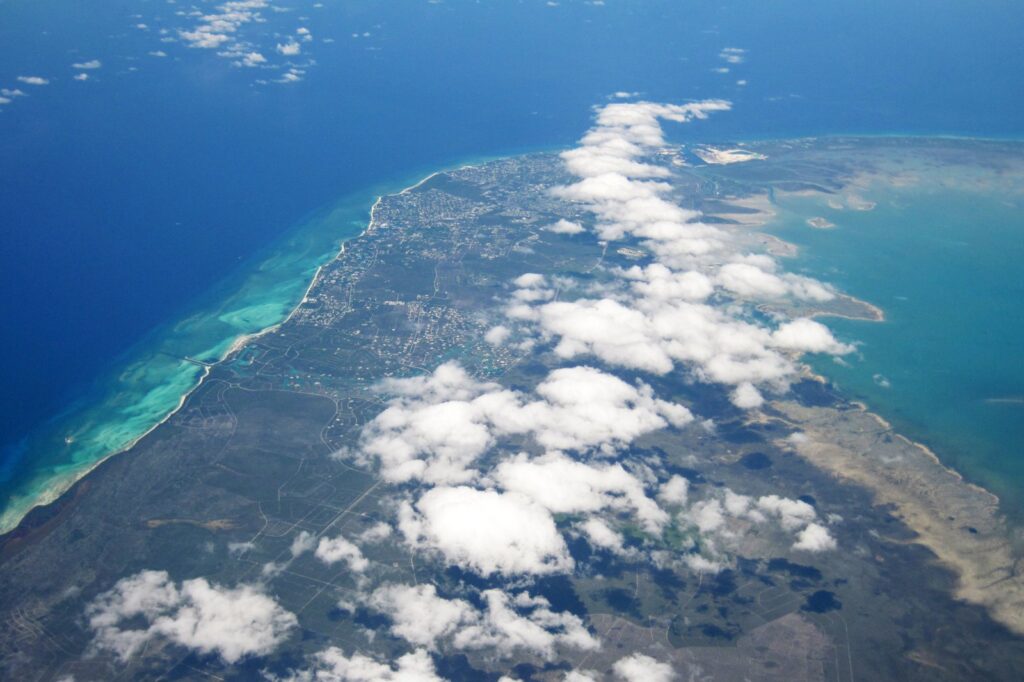
The reported epicenter sits on the Little Bahama Bank, a shallow carbonate platform that forms part of the Lucayan Archipelago. The Bahamas comprises 700 islands and more than 2,500 cays spread across 470,000 square kilometers of ocean space, north of Cuba and southeast of Florida. The bank’s shallow water can complicate seismic wave propagation and make automated depth estimates less reliable than in deep-ocean settings. The distance from the epicenter to the U.S. East Coast — roughly 160 miles to Palm City, Florida, where two users reported feeling shaking — also factored into the lack of a tsunami message, as the U.S. National Tsunami Warning Center covers the Atlantic and Gulf coasts and Puerto Rico but issued no alert for the region.
Why No Tsunami Message Was Issued
The U.S. National Tsunami Warning Center issued no message for the U.S. East Coast following the report. Officials rely on confirmed data from multiple agencies before issuing alerts. With the event absent from USGS and European catalogs, the depth poorly constrained, and the epicenter on a shallow bank far from major population centers, the automated report did not meet the threshold for a tsunami warning. Bahamas authorities had not commented publicly on the event as of publication, and no damage or injuries had been reported.
Sources
- Despite Reports of Strong Earthquake in Bahamas, No US East Coast Tsunami Threat
- The Bahamas
- Five Things to Know: Badgers head to Bahamas for Baha Mar Championship | Wisconsin Badgers
- Johnny Depp fled Hollywood spotlight for quiet Bahamas life where ‘nobody’s pointing a camera at me’
- Baha Mar Championship – Wisconsin vs. Seton Hall: Live updates, score
- SC weather update: Strong winds, heavy rain and coastal flooding expected Saturday
Photo: James St. John (CC BY-SA 4.0)