
At the close of June 2024 and into the first days of July, Hurricane Beryl moved across the Caribbean, leaving a trail that meteorologists describe as unprecedented for the time of year. The storm originated as a tropical wave that departed the African coast on June 25. Three days later, on June 28, it organized within the Atlantic’s Main Development Region, the area that typically fuels the season’s most powerful systems later in the calendar.
From that point Beryl underwent rapid intensification, a process in which wind speeds climb sharply over a short period. This swift strengthening propelled the hurricane to Category 4 strength and then to Category 5, making it the earliest storm ever recorded in the Atlantic to reach both those thresholds.
In doing so, Beryl also became the strongest hurricane to develop in the Main Development Region before the month of July, a mark that underscores the unusual warmth of ocean waters and atmospheric conditions present at that time. The hurricane’s first landfall occurred on July 1 when it struck the island of Carriacou, Grenada, as a Category 4 system. Damage there was described as significant.
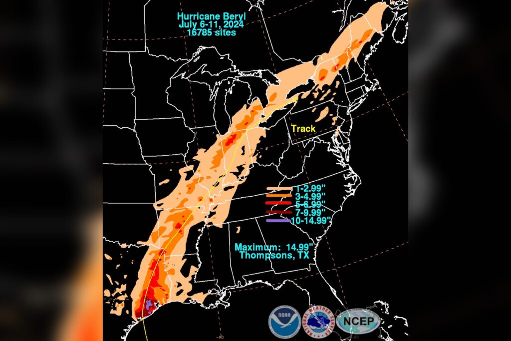
After crossing Carriacou, Beryl continued westward, affecting the Yucatán Peninsula before moving into the Gulf Coast of the United States. Its track crossed multiple nations and territories, each confronting a hurricane that arrived both earlier than usual and with extraordinary intensity.
To place Beryl’s achievement in context, only one other Atlantic hurricane has attained Category 5 status in July: Hurricane Emily in 2005. The rarity of such an event is highlighted by the fact that, in nearly two decades, only these two storms have reached that level during the month traditionally considered still early in the hurricane season. The Saffir‑Simpson scale, which classifies storms solely by sustained wind speed, placed Beryl at its highest category despite the Atlantic normally still warming up in late June and early July.
The 2024 Atlantic hurricane season began with Beryl as its second named storm, its first hurricane, its first major hurricane, and its first Category 5 system to reach the top of the scale. This cluster of “firsts” for a single cyclone sets an early tone for the months ahead.
Should the environmental factors that enabled Beryl’s rapid growth persist, forecasters warn that the remainder of the season could see additional storms that develop quickly and strike with considerable force. The Main Development Region is often referred to as the nursery for Atlantic hurricanes because it supplies the energy needed for storm formation. Beryl’s emergence there before July demonstrates that the nursery was already active well ahead of the typical peak.
For the islands and coastal areas that felt its impact, the immediate priority is recovery. Carriacou’s direct hit from a Category 4 hurricane will require substantial time and financial resources to rebuild.
On the Gulf Coast, Beryl served as an early test of preparedness for a system that arrived before the season’s usual maximum. Rapid intensification also complicates forecasting. A storm that strengthens swiftly can outpace predictive models, leaving communities with less time to prepare. Beryl exemplifies this challenge, acting as a data point that illustrates how quickly a hurricane can escalate when conditions are favorable.
While records such as Beryl’s are expressed in numbers, their true significance emerges when the storm meets land. The real narrative is that the Atlantic is producing storms of this magnitude in July, a pattern that deviates from historical norms.
Whether this represents a shift toward a new normal remains a question that future data will answer. For now, Hurricane Beryl stands as an early warning that the 2024 season possesses considerable power, and it displayed that power well before the customary peak.




