
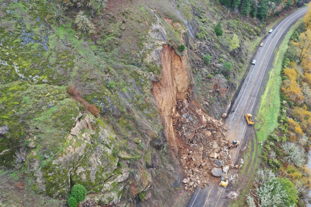
TONOSÍ, October 18, 2026 — A preliminary satellite assessment has identified at least 2,351 landslides triggered by the magnitude 7.5 earthquake that struck Panama on October 9. The seismic event, which centered 39 kilometers northwest of Tonosí in Los Santos province, has caused significant disruption to regional infrastructure and prompted an ongoing recovery effort.
Satellite Data Reveals Scale of Terrain Shift
The Institute of Geosciences of the University of Panama conducted the landslide analysis using image processing from the Copernicus Sentinel-2 L2A system. This satellite technology allowed researchers to map the extent of ground movement across the affected regions. According to the Institute of Geosciences, the initial count of 2,351 landslides serves as a first approximation of the geological impact.
The Institute of Geosciences noted that these results remain preliminary. Cloud cover during the satellite’s passage over the region prevented the observation of some areas, suggesting that the total number of landslides could increase as new imagery is processed and ground-level validation continues. The analysis provides a clear view of the seismic intensity, though the specific impact of these landslides on individual homes and infrastructure remains under further assessment.
Regional Impact and Human Toll
The earthquake, which occurred at 12:56 pm on October 9, has resulted in a challenging recovery period for the central provinces. According to government reports from October 16, the disaster left one person dead and 26 others injured. Nearly 3,000 homes have sustained some form of damage across the affected areas.
The most significant damage is concentrated in the provinces of Coclé, Herrera, Los Santos, and Veraguas. Authorities have been working to stabilize these areas as families grapple with the aftermath. As of October 16, the government reported that it had assisted 22,400 people and conducted assessments for 6,800 families. To support those displaced by the earthquake, officials have maintained 46 shelters for residents who are currently unable to return to their homes.
Infrastructure Recovery Efforts
Restoring access to the affected provinces has been a primary focus for local authorities. The earthquake caused damage to 22 bridges, complicating transport and logistics in the mountainous regions of the Azuero Peninsula. Despite the structural challenges, progress has been made in clearing transit routes.
As of October 16, authorities reported that 92% of the roads affected by structural collapses had been reopened. The restoration of these networks is essential for the continued delivery of aid and the movement of resources into the hardest-hit communities. While the immediate focus remains on recovery and infrastructure repair, the government continues to monitor the situation in the central provinces to ensure that all damaged areas are reached.
The earthquake’s impact on the terrain and the subsequent landslide activity highlight the vulnerability of the region’s mountainous topography to seismic events. As the Institute of Geosciences continues to incorporate new satellite data, the full scope of the geological transformation will become clearer. For now, the priority for the government remains the welfare of the thousands of families assessed following the October 9 event.
Landslide Distribution and Geographic Focus
The Institute of Geosciences identified landslide concentrations primarily in the provinces of Coclé, Herrera, Los Santos, and Veraguas, with the epicenter located 39 kilometers northwest of Tonosí in Los Santos province. Satellite imagery from the Copernicus Sentinel-2 L2A system enabled mapping of ground movement across these regions, revealing a clustered pattern of slope failures in mountainous terrain.
The analysis highlighted specific areas such as Malena in Veraguas province, where landslides were visibly documented on mountainsides following the October 9 earthquake. These geographic details were derived from image processing that located affected zones based on seismic intensity and topographic vulnerability.
Due to cloud cover during satellite passes, some areas remained unobserved, meaning the current count of 2,351 landslides is a first approximation that may increase as additional imagery becomes available and ground validation progresses. The Institute emphasized that this preliminary data reflects the initial scope of terrain disruption but does not yet specify how many landslides impacted specific infrastructure like roads or homes.
Sources
- 2351+ Landslides at Least were Caused by the Earthquake in Panama. – Newsroom Panama
- Magnitude 2.8 quake hits 16 km northwest of Lubin, Poland, in the afternoon
- Panama declares state of emergency as powerful quake aftershocks rattle communities | CBC News
Photo: Oregon Department of Transportation (CC BY 2.0)




