
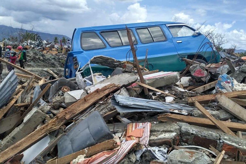
JAKARTA, August 15 — A powerful earthquake with a magnitude of 7.7 struck Indonesia, causing significant damage and killing at least two people, according to the United States Geological Survey (USGS). The tremor, which occurred at an unspecified depth, had its epicenter in an undisclosed region, with the shockwaves felt across multiple provinces. Indonesian authorities swiftly issued tsunami warnings, urging coastal residents to move to higher ground.
The status of these warnings—whether they were later lifted or confirmed—remains unclear. Early findings suggest the quake triggered landslides in affected areas, disrupting transportation and damaging critical infrastructure.
Local disaster management agencies reported the collapse of several buildings, though the exact number has not been specified. Rescue operations are currently underway. Indonesia’s position on the Pacific Ring of Fire makes it particularly vulnerable to seismic and volcanic activity.
The country has endured devastating earthquakes in recent years, including a 7.5-magnitude quake in 2018 that resulted in over 4,300 fatalities in Sulawesi. The National Disaster Mitigation Agency (BNPB) is leading relief efforts, with support from international organizations such as the Red Cross.
The USGS recorded multiple aftershocks following the initial quake, though the magnitude range of these tremors has not been detailed.
What to Watch Next
The encouraging part is the rapid response from authorities and aid organizations. However, the situation remains fluid, and further updates on casualties, structural damage, and aftershock activity are expected. Residents in affected areas should follow official guidance and stay vigilant.
Indonesia’s location along the Pacific Ring of Fire, a horseshoe-shaped zone encircling the Pacific Ocean, exposes it to frequent earthquakes and volcanic eruptions due to the movement of tectonic plates. This geological setting has historically led to some of the world’s most powerful seismic events, often accompanied by tsunamis that can devastate coastal communities.
The country’s disaster preparedness systems, including early warning mechanisms and evacuation protocols, have been strengthened in recent years to mitigate the impact of such events. Earthquakes of this magnitude can have widespread consequences, including structural damage, landslides, and disruptions to essential services such as power and communications. In the aftermath of such disasters, infrastructure damage often hampers rescue and relief operations, particularly in remote or hard-to-reach areas.
The involvement of national and international aid organizations is critical in providing medical assistance, shelter, and supplies to affected populations. The 2018 Sulawesi earthquake and tsunami highlighted the vulnerabilities of regions prone to such natural disasters, prompting reviews of building codes, emergency response strategies, and public awareness campaigns.
These efforts aim to reduce casualties and improve resilience in the face of future seismic activity. The current event underscores the ongoing need for vigilance and preparedness in earthquake-prone regions.




