
JAKARTA, August 15 — Indonesia sits astride the Pacific Ring of Fire, a vast 40,000-kilometer horseshoe-shaped belt of volcanic and seismic fury that girdles the Pacific Ocean. The region holds roughly 75% of the planet’s active volcanoes and accounts for about 90% of its earthquakes, including some of the most powerful tremors ever recorded. These forces arise from the collision and subduction of tectonic plates, where the Pacific Plate and smaller plates dive beneath continental crust.
Indonesia itself lies at the junction of three major plates: the Eurasian, Pacific, and Indo-Australian. This triple convergence makes the archipelago one of the most seismically active places on Earth.
Historical Catastrophes
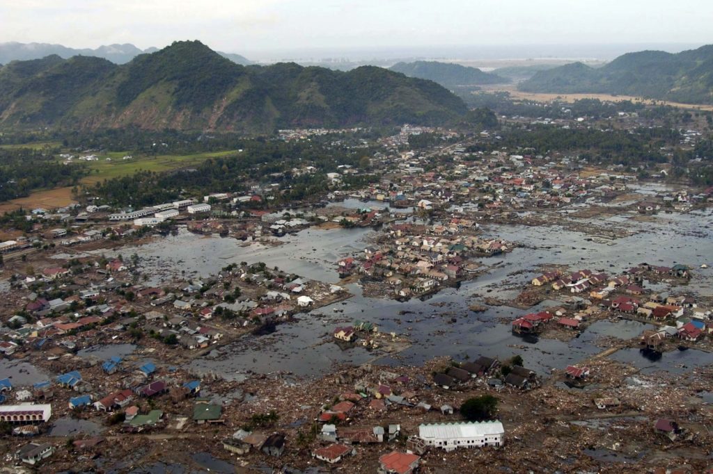
A 9.1-magnitude earthquake off Sumatra in 2004 unleashed a tsunami that killed over 230,000 people across 14 countries. More recently, the 2018 Sulawesi earthquake and tsunami claimed over 4,300 lives. The USGS reports that Indonesia endures several significant quakes—magnitude 6.0 or higher—each year.
Indonesia’s disaster management agencies, including the BNPB, have installed early warning systems and crafted evacuation plans to blunt the toll of future events. Yet the country’s dense population and fragile infrastructure still pose steep obstacles to full preparedness.
What to watch next: ongoing upgrades to detection networks and public drills that may further reduce risk in this restless zone. The Pacific Ring of Fire is a well-known geological feature, notorious for its intense volcanic and seismic activity. This region encircles the Pacific Ocean in a vast horseshoe-shaped belt.
The Ring of Fire is a direct result of the movement and interaction of tectonic plates, which form the Earth’s outer shell. When these massive plates collide, one may be forced beneath the other, a process known as subduction, leading to volcanic and seismic activity.
Indonesia’s unique position at the junction of three major tectonic plates—the Eurasian, Pacific, and Indo-Australian—makes it particularly susceptible to earthquakes and volcanic eruptions. This complex geological setting has shaped Indonesia’s landscape and presents ongoing challenges for its population, as the frequent seismic events can have devastating consequences. The impact of earthquakes in Indonesia has been historically significant, with several events leading to catastrophic loss of life and widespread destruction.
A 9.1-magnitude earthquake off Sumatra in 2004 unleashed a tsunami that killed over 230,000 people across 14 countries. The 2018 Sulawesi earthquake and tsunami claimed over 4,300 lives. These events have prompted the development of disaster management strategies, including early warning systems and evacuation plans by agencies such as the BNPB.
However, the high population density and fragile infrastructure remain critical obstacles to full preparedness. Ongoing efforts to enhance detection networks and public awareness through drills are essential steps in preparing for future seismic events.
As Indonesia continues to navigate the challenges posed by its location within the Pacific Ring of Fire, these measures aim to minimize the potential impact of earthquakes and tsunamis, ultimately saving lives and reducing the scale of destruction.




