
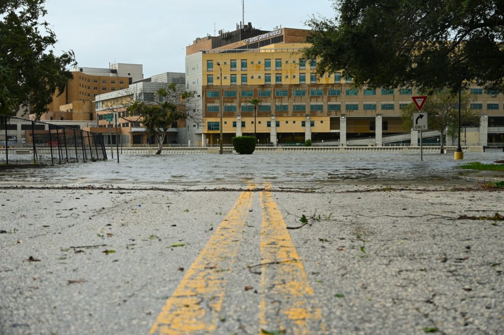
Hurricane Idalia made landfall in Florida as a Category 3 storm on August 30, 2023. But the real story may not be the moment the eye crossed the coast. It is what happened miles away, in places the storm never directly hit.
Flooding was reported in the Tampa Bay area. Tampa sits on the Gulf Coast, well south of where Idalia came ashore.
Yet water rose there. Two people died in vehicle accidents, both attributed to the storm. That detail — deaths far from the hurricane’s center, flooding in a city outside the cone — is the one that should worry Floridians most.
The storm did not start as a hurricane. It began as a low-pressure area that crossed Central America from the eastern Pacific Ocean.
It meandered in the western Caribbean Sea. By August 26 it was a tropical depression. A day later, a tropical storm.
It was given the name Idalia. Then it entered the Gulf of Mexico and underwent rapid intensification. That is a phrase that keeps appearing in hurricane reports, and it keeps meaning trouble.
Rapid intensification is when a storm’s wind speeds jump dramatically in a short period. Warm water fuels it.
The Gulf of Mexico in late summer is very warm. Idalia went from a tropical storm to a Category 3 hurricane before it hit Florida. That is a fast climb.
It gave residents and officials less time to prepare than the forecast had suggested days earlier. Now the cleanup begins.
The authorities are working to restore essential services. Power outages are reported in several locations. Some areas are still feeling the storm’s effects.
But the questions that will follow are harder to fix than downed power lines. Flooding in Tampa Bay, despite the storm making landfall elsewhere, raises questions about infrastructure and disaster preparedness. Tampa is not a stranger to hurricane threats.
But a storm that hits farther north can still push water into Tampa Bay. Storm surge does not care about the official landfall point.
It follows the wind and the shape of the coast. Two deaths. Both from vehicle accidents.
That is a specific kind of warning. People get in cars during storms.
They drive into water they cannot see. They misjudge the depth or the current. The storm does not have to be overhead to kill.
Florida will assess the damage. Officials will study what worked and what did not. But the pattern is familiar.
A storm strengthens fast. It hits somewhere.
It floods somewhere else. People die in ways that seem preventable after the fact. Then the next storm comes.
Idalia’s trajectory was not unusual. Low-pressure systems cross Central America regularly.
They spin up in the Caribbean. They move into the Gulf. But the rapid intensification phase is becoming more common, or at least more noticed.
Warmer seas give storms more energy. That is physics, not politics. The Tampa Bay area got flooding.
Hillsborough County got flooding. That includes Tampa.
A city that has long been told it is due for a big one. This was not the big one. It was a Category 3 that hit elsewhere.
And still the water came. Residents and officials will look for lessons.
They always do. The question is whether those lessons stick. Whether building codes get stricter.
Whether evacuation zones get redrawn. Whether people stop driving into floodwater. Idalia is over.
The cleanup is real. The power outages are real.
The two dead are real. And the next storm is already somewhere out there, over warm water, waiting to intensify.




