
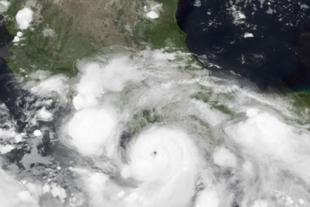
Hurricane John’s Unusual Return Brings Second Strike to Mexico’s Southern Coast
On September 22 a low‑pressure area off Mexico’s southern Pacific coast organized into a tropical depression. By September 24 it had strengthened to a Category 3 hurricane and made landfall near Marquelia in the state of Guerrero. The initial impact destroyed homes, turned streets into rivers and triggered mudslides that buried buildings.
After crossing the rugged terrain of Guerrero the system weakened over land, lost its tropical characteristics and appeared to dissipate. However, the disturbance remained over warm waters off the coast, where favorable atmospheric conditions allowed it to reorganize.
Regaining strength, the storm turned back toward the mainland. On September 27 the revived cyclone struck again, this time making landfall near Tizupan in Michoacán. The second hit came while the ground from the first event was still saturated, so the additional rainfall produced even deeper flooding. Rivers that had not yet receded rose higher, and floodwaters spread into areas that had never experienced inundation before.
The back‑to‑back landfalls are atypical for eastern Pacific hurricanes, which normally lose energy after crossing the Sierra Madre del Sur and fade away. Hurricane John instead followed a loop: weakening, dissipating, re‑intensifying over water, and then moving inland a second time before finally breaking apart over the coastal mountains.
The entire evolution — from the first offshore depression to the final dissipation — unfolded in less than a week. For residents of Guerrero and Michoacán the stakes were immediate. Record‑breaking rainfall caused catastrophic flooding, mudslides severed roadways, and emergency crews faced a moving target.
As soon as damage assessments began after the initial strike, the storm reformed and delivered a second blow. That second blow did not merely add more damage; it prolonged the crisis.
Flooded communities needed clean water, destroyed houses required reconstruction, and crops that had been submerged in the fields were lost. Families in small coastal towns found themselves starting from a worse position than they had anticipated after the first hit. The storm’s erratic path also highlighted the limits of conventional forecasting.
Tropical cyclones do not always obey simple track predictions; John weakened, then strengthened, died, and returned. Forecasters had to issue updated warnings continuously, and residents had to stay alert far longer than usual.
In such a situation the margin for error is narrow, and a delayed warning can become deadly. Response efforts have been led by local and state emergency agencies. They confronted a system that refused to stay dead, complicating logistics: supplies had to be moved repeatedly, shelters kept open, and search‑and‑rescue teams remained active even when the weather deteriorated again.
The second landfall on September 27 added not only extra damage but also valuable time lost to recovery, as each day of standing water postpones the start of rebuilding. Although the cyclone finally dissipated for good over the coastal mountains, its effects linger.
Water still stands in many places, mud remains on roads and fields, and wreckage litters the landscape. For the people of Guerrero and Michoacán the storm may have passed, but the process of counting its cost is only beginning.




