More than 20 years ago, geographer Alceu Ranzi looked out of a plane window over the Brazilian Amazon and saw a perfect circle cut into the ground. Nothing in nature makes a shape like that. He was right, and what he spotted from a seat in the air has now grown into one of the largest findings in the region’s archaeology.
A study published on July 29, 2026 in Nature, led by archaeologist Martti Pärssinen of the University of Helsinki, reports that a lidar survey flown over southwestern Amazonia turned up 432 earthworks. Of those, 396 were previously unknown, according to ScienceAlert. Science put the figure at nearly 400.
How the survey worked
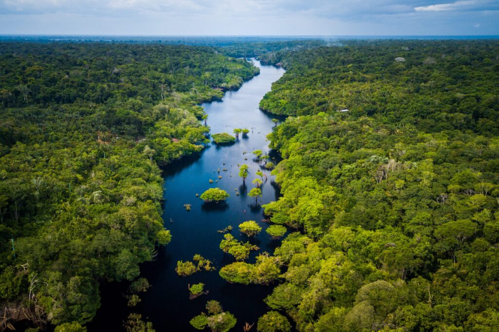
Lidar fires laser pulses from an aircraft. Some slip through gaps in the canopy and bounce off the ground, which lets researchers rebuild the landscape without cutting a single tree. Before it came along, scientists could only recognize such sites in deforested areas.
The team flew long transects of roughly 450 kilometers (280 miles) and covered 4,497 square kilometers (1,736 square miles) of rainforest. It is a small slice. Pärssinen said the number of geoglyphs packed into less than 3 percent of Greater Amazonia was what surprised him most.
The survey crosses Acre and Amazonas, two Brazilian states bordering Venezuela, Colombia, Peru and Bolivia. Earthworks were already known there. The new data mark the western and northern edges of the geoglyph-building society that researchers call Aquiry. The scientists had not expected such high numbers so far from major rivers, which historically fed large populations.
What the earthworks are
Most are geoglyphs, ditches that form squares and circles, along with pentagrams and octagons. Some combine shapes, such as circles inside a perfect square. Ditches could be meters deep, and straight roads link the sites. Early digs found traces of coal that allowed radiocarbon dating to about 2500 years ago, but very little sign of everyday life, which suggests they were mostly ceremonial.
The Apuriña people of Acre call the geoglyphs a kind of kymyrury, according to anthropologist Francisco Apuriña, who worked on the study. The word describes places that are “home to spirits.”
“At the same time that Pythagoras was in ancient Greece doing his theorem, we had people here in Amazônia doing geometry,” Ranzi said.
Big numbers, carefully hedged
From their data and earlier surveys, the researchers estimate that the Aquiry may have covered as much as 183,000 square kilometers at their peak, with around 1.2 to 3 million people and 24,000 to 30,000 earthworks. Science reported that the team sees more than 20,000 additional earthworks waiting in similar dense zones. Earlier estimates predicted about 10,000 for the whole Amazon.
Pärssinen pictured clearings with large wooden longhouses, fields of maize, manioc, squash and cotton, and managed fruit and nut trees. The presence of Brazil nut trees around the earthworks, Ranzi said, points to domestication. “That old idea of a pristine Amazônia falls apart,” he said. Vinicius Peripato of Brazil’s National Institute for Space Research, who was not involved, said that 20 years ago there was no record of pre-Columbian occupation in the forest.
The Aquiry vanished around 850 CE, and Pärssinen says the central open question is why. “What happened between approximately [CE] 850 and 1000?” he asked.
Whose data is it?
Some Indigenous groups worry that published lidar images could reveal the location of their territories or sacred sites. Pärssinen said the team removed all earthwork images from demarcated Indigenous territories before releasing the data. Apuriña put the tension plainly: some things do not need to be disclosed, but others can be shown responsibly to defend Indigenous land claims.
Eduardo Neves of the University of São Paulo, who was not part of the study, called lidar “revolutionary.” He leads Amazônia Revelada, a project that uses it to find earthworks in areas threatened by deforestation. Brazil’s constitution requires that archaeological sites be federally protected. Amazônia has lost more than 13% of its vegetation cover in 40 years, and scientists say the region might not sustain itself if that passes 20%.
Sources
- 'Completely Transformed My Understanding': Scientists Uncover Hundreds of Hidden Structures Beneath The Amazon
- Odd shapes hidden in dense Amazon rainforest reveal sprawling ancient civilization | Science | AAAS