
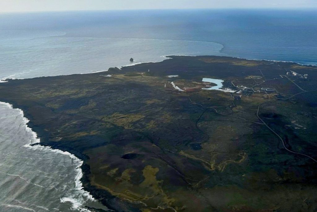
A magnitude 5 earthquake struck this submarine ridge early Tuesday morning, according to the U.S. Geological Survey. The USGS detected the event at 08:30 UTC through its real-time global seismic monitoring network, placing the quake’s hypocenter at a depth of 10 kilometers.
No tsunami warning was issued. At that shallow depth — less than 70 kilometers, which is the threshold for classification as a shallow earthquake — the shaking near the epicenter was likely stronger than it would have been for a deeper quake of the same magnitude. A magnitude 5 earthquake is categorized as moderate and can produce minor to moderate damage in the immediate vicinity of the epicenter.
Depth, Monitoring, and Immediate Impact
Depth remains a critical factor in assessing an earthquake’s surface effects. Shallow events, defined as those shallower than 70 kilometers, typically generate more intense ground motion than deeper ones of the same size. At just 10 kilometers deep, Tuesday’s quake falls firmly in the shallow category, meaning the energy released reached the surface with relatively little attenuation, increasing the likelihood of noticeable shaking in the affected area.
The USGS’s global monitoring system, which tracks seismic activity in real time, allows scientists to rapidly determine magnitude, depth, and location. That rapid analysis is essential for evaluating whether a tsunami warning is necessary; in this case, no such warning was issued.
A magnitude 5 earthquake is classified as moderate on the magnitude scale, and while it is not considered major, it carries the potential for minor structural damage or moderate disruption in the epicentral region.
Aftershocks and Regional Seismic History
Aftershocks are a common consequence of an earthquake of this size, and the USGS advises people in the area to remain alert for further shaking in the days and weeks ahead. These aftershocks can range from barely perceptible tremors to quakes strong enough to cause additional damage. The Reykjanes Ridge is no stranger to such activity.
Over the past two decades, at least 47 earthquakes of magnitude 5.0 or greater have been recorded within a 300-kilometer radius of Tuesday’s event. The strongest among them was a magnitude 5.9 quake that occurred in 2019.
This history underscores the persistent seismic hazard in the region and the importance of continued monitoring and preparedness.
Geological Context and Long-Term Significance
The Reykjanes Ridge is a submarine continuation of the Mid-Atlantic Ridge near Iceland, marking a divergent plate boundary where the North American and Eurasian tectonic plates are moving apart. The existence of a ridge beneath the northern Atlantic was first inferred in the mid-1800s from early ocean soundings.
Later, sonar technology confirmed a continuous mountain system crossing the ocean floor. Detailed mapping in the 1950s revealed that the ridge contains a central valley and is associated with frequent earthquakes. That work provided key evidence supporting the theories of seafloor spreading and plate tectonics, which explain how the ocean crust forms and moves.
The ridge itself formed as the supercontinent Pangaea broke apart over vast spans of ancient geologic time, and its slow spreading continues to shape the North Atlantic seafloor today. Such divergent boundaries are significant because they generate both earthquakes and volcanic activity, processes that gradually reshape coastlines and pose ongoing natural hazards for readers who live near the ridge.
The shifting crust in this region remains a persistent source of seismic risk, a reality underscored by Tuesday’s moderate but shallow event.




