Five minutes. In regions with dense seismic networks, that is how fast the U.S. tsunami warning centers can put out a first message, according to NOAA. Where the network is thinner, it takes 10-15 minutes. The bottom line: a tsunami warning system is a race between a wave and a data pipeline, and the pipeline has to win.
The race is possible because of a speed gap. Seismic waves travel about 100 times faster than tsunamis, NOAA says, so news of an earthquake arrives before the wave it may have set off. In deep water a tsunami can move over 500 mph and cross an entire ocean in less than a day. Near land it slows to roughly 20 or 30 mph.
How a warning gets made
Three details about a quake decide whether a message goes out: location, depth and magnitude. If the earthquake meets the centers’ criteria, forecasters turn to water-level data to see whether a wave actually exists.
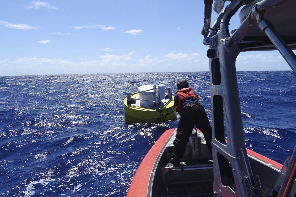
That data comes from two places. One is an array of coastal water-level stations, mostly on harbor piers. The other is the DART network, short for Deep-ocean Assessment and Reporting of Tsunami. Each DART system pairs a pressure recorder anchored on the seafloor with a moored surface buoy. When a tsunami passes overhead, the recorder registers the change in water pressure. An acoustic link carries the signal up to the buoy, and the buoy relays it by satellite to the warning centers. NOAA counted 39 U.S. DART systems as of 2016, spread across the Pacific and Atlantic, the Gulf of America and the Caribbean.
Two U.S. centers
The Pacific Tsunami Warning Center in Honolulu was set up in response to the tsunami that followed the magnitude 8.6 Aleutian Islands earthquake of April 1, 1946. Most of the 167 lives lost were in Hawaii, where waves reached as high as 55 feet. The National Tsunami Warning Center in Palmer, Alaska, was established after the magnitude 9.2 Prince William Sound earthquake of March 27, 1964, which caused about 124 deaths. Palmer serves the continental United States, Alaska and Canada. Honolulu serves Hawaii and the U.S. Pacific and Caribbean territories, and it is the primary international forecast center for UNESCO’s Intergovernmental Oceanographic Commission warning systems in the Pacific and the Caribbean.
A real test in 2025
On 29 July 2025 a magnitude 8.8 earthquake struck off Russia’s Kamchatka Peninsula and sent a tsunami across the Pacific. Within 10 minutes the first threat message was on its way, the commission found. It later surveyed all 46 member states of the Pacific system. Thirty replied. The assessment found the warnings reached the people who needed them, but a few states reported delays in receiving messages, remote areas had connectivity problems, and community preparedness varied.
“This event clearly demonstrates the value of the PTWS in saving lives,” said Dr. Dakui Wang, who chairs the Pacific group.
Where the gaps are
Not every wave gives that much notice. NOAA says nonseismic tsunamis, from landslides, volcanoes or weather, are harder to forecast and can arrive with little to no warning.
Cost is the other limit. Miguel González Herráez of the University of Alcalá says DART buoys and ocean-bottom seismometer arrays “come with high deployment and maintenance costs and have limited reliability.” His EU-funded SAFE project turns existing submarine fibre-optic cables into sensors. The team reports it can detect sea level changes with an accuracy of less than 20 cm, enough to confirm a tsunami while it is still 50 km offshore. It says capital and operating costs are at least 10 times lower.
Sources
- Tsunami Frequently Asked Questions – U.S. Tsunami Warning Centers (NOAA / National Weather Service)
- When the Pacific shook: how the tsunami warning system rose to the Kamchatka test | Intergovernmental Oceanographic Commission (UNESCO)
- A more reliable and cost-effective tsunami early warning system | SAFE Project | CORDIS | European Commission