
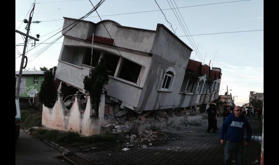
A magnitude 5.1 earthquake centered 33 kilometers south-southwest of this coastal city struck at 16:01 UTC on July 17, according to the U.S. Geological Survey. The USGS detected the event through its real-time global seismic monitoring network, reporting a depth of 64.924 kilometers.
That figure places the rupture squarely in the shallow earthquake category, defined as less than 70 kilometers deep. Seismologists note that shallow events of this kind typically produce stronger shaking at the surface than deeper earthquakes of the same magnitude. No tsunami warning was issued.
Earthquakes in the magnitude 5 range are considered moderate. Depending on local building standards and distance from the epicenter, such events can cause minor to moderate damage.
The depth of 64.924 km means the rupture occurred relatively close to the surface, a factor that amplifies ground motion compared with deeper events of identical magnitude. For those monitoring risk, the shallow depth is a key detail: it raises the likelihood that shaking will be felt more intensely in communities near the epicenter.
Seismic History and Regional Context
The area surrounding Puerto Madero is seismically active. Over the past two decades, at least 380 earthquakes of magnitude 5.0 or greater have been recorded within about 300 kilometers of this location.
The strongest during that period was a magnitude 8.2 earthquake in 2017. This geological setting is shaped by Mexico’s position atop several tectonic plates, a feature that has produced frequent earthquakes across the country for centuries. Measured by the long-term record, seismic activity is a longstanding feature of the region, making preparedness a persistent concern for communities nationwide.
Mexico, a North American country bordered by the United States to the north and Guatemala and Belize to the southeast, has coastlines along the Pacific Ocean, Gulf of Mexico, and Caribbean Sea. It is a nation with deep historical roots, home to ancient Mesoamerican civilizations such as the Olmecs, Maya, and Aztecs before Spanish colonization began in the early 16th century.
Modern Mexico emerged after a decade-long independence struggle in the early 19th century, followed by periods of political instability, foreign intervention, and revolution. The 20th century brought industrial growth, social upheaval, and economic shifts, including the adoption of free-market policies and regional trade agreements. Throughout this history, the land’s tectonic volatility has remained a constant challenge, with earthquakes shaping infrastructure, disaster response, and public awareness.
Aftershocks and Monitoring
Seismologists note that aftershocks are common following an earthquake of this size. They may continue for days or weeks.
People in the affected area are generally advised to be prepared for further shaking. The USGS continues to monitor the area through its global seismic network for any subsequent activity. The bottom line, based on the data available, is that this was a moderate, shallow earthquake in a seismically active region, with no tsunami threat.
For residents and regional observers, the event serves as a reminder of the persistent geological forces at work along Mexico’s Pacific margin, where the Pacific, Cocos, and North American plates interact, generating the earthquakes that have marked the country’s past and will continue to shape its future.




