
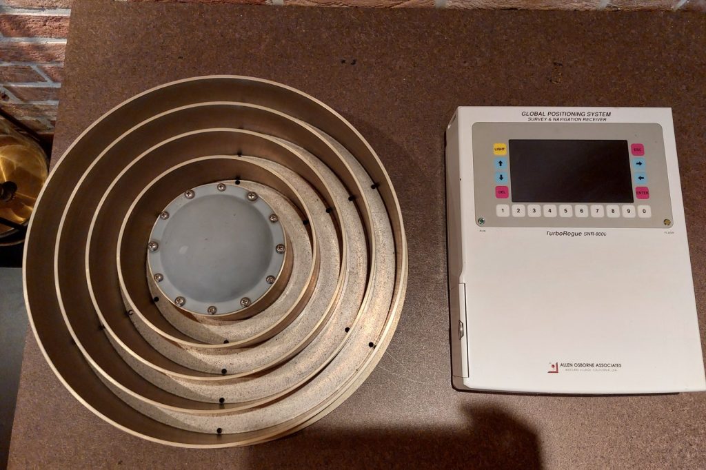
WASHINGTON, July 11 — The Global Positioning System, the invisible architecture that guides everything from precision munitions to commercial airliners to smartphone map apps, operates on a principle that is widely misunderstood even among those who depend on it daily. It is not triangulation. It is trilateration.
Strategically, the distinction matters. Triangulation measures angles.
Trilateration measures distances. A GPS receiver does not look at where a satellite is in the sky and calculate an angle back to it. It listens for how long a signal took to arrive and, knowing that signal travels at the speed of light — 299,792 kilometers per second — computes a precise distance.
Do that with at least four satellites, and the receiver can solve for four unknowns: latitude, longitude, altitude, and time. The calculus is elegant but demanding.
Each satellite broadcasts two pieces of data: its precise orbital position, known as ephemeris data, and an extraordinarily accurate time signal. That time signal comes from atomic clocks — cesium and rubidium instruments aboard each satellite that are accurate to within one second in 100,000 years. The receiver measures the time delay between when the signal left the satellite and when it arrived.
Since the signal travels at the speed of light, even a tiny clock error produces a large position error. That is why the receiver must solve for time as a fourth variable, effectively synchronizing its own clock to the satellite network’s atomic time. The broader stakes of this technology are hard to overstate.
The satellites themselves orbit at an altitude of approximately 20,200 kilometers, completing two orbits per day. They broadcast on multiple frequencies, each serving a different purpose.
The L1 frequency, at 1575.42 megahertz, is the civilian signal — the one in every smartphone and car navigation system. The L2 frequency, at 1227.60 megahertz, is reserved for military use. A newer frequency, L5 at 1176.45 megahertz, has been modernized for safety-of-life applications — aviation approaches, maritime navigation, and other scenarios where a failure could be catastrophic.
What this signals to defense analysts and technology strategists is a layered system designed for resilience. The control segment is centralized but far from fragile.
The master control station sits at Schriever Air Force Base in Colorado. Monitor stations are scattered across the globe — Hawaii, Ascension Island, Diego Garcia, Kwajalein, and Cape Canaveral. These stations track the satellites constantly, measuring their orbits and clock performance, and uploading corrections to keep the system accurate.
But accuracy is never perfect. Errors creep in from multiple sources. The ionosphere and troposphere delay the signals as they pass through the atmosphere.
Satellite clocks drift, however slightly. Orbital predictions are not exact.
Signals can bounce off buildings or terrain — multipath effects — before reaching the receiver. And the receiver itself introduces noise into the measurement. For most civilian users, these errors amount to a few meters of uncertainty.
That is good enough for turn-by-turn directions. For military operations, precision agriculture, surveying, or aviation, it is not.
The solution is Differential GPS, or DGPS. A fixed ground station at a known location measures the errors in the satellite signals and broadcasts corrections to nearby receivers. The result is sub-meter accuracy.
The system’s design reflects a Cold War calculus that has only grown more relevant. The United States built GPS as a dual-use technology: military precision for guided weapons and force coordination, civilian access for economic and scientific benefit. That dual-use nature is now under strain.
Adversaries have developed jamming and spoofing capabilities. The introduction of the L5 frequency and the continued investment in the control segment are not merely technical upgrades.
They are strategic hedges. For the journalist covering international conflict and technology, the story of GPS is not a physics lesson. It is a geopolitical one.
The system that guides a cruise missile into a bunker is the same system that guides a farmer’s tractor across a field. The same atomic clocks that enable a soldier to call in an artillery strike with coordinates accurate to a few meters also enable a delivery drone to land on a doorstep.
The broader stakes are about who controls the signal, who can deny it to others, and who can protect their own access to it. The next phase of this technology will likely focus on resilience. The United States is modernizing the satellite constellation, adding new signals and hardening the system against electronic attack.
Other nations are building their own systems — Europe’s Galileo, Russia’s GLONASS, China’s BeiDou — creating a world in which no single country can hold the entire positioning, navigation, and timing architecture hostage. But for now, the fundamental principle remains the same. At least four satellites.
Four unknowns. Distance, not angle.
Trilateration, not triangulation. And a network of atomic clocks orbiting 20,200 kilometers overhead, keeping time to within a second in 100,000 years, so that the rest of us can know exactly where we are.
{“@context”: “https://schema.org”, “@type”: “NewsArticle”, “headline”: “GPS Trilateration: Science of Satellite Signals Explained”, “description”: “WASHINGTON, July 11 — The Global Positioning System, the invisible architecture that guides everything from precision munitions to commercial airliners to smartphone map apps, operates…”, “datePublished”: “2026-07-11T09:30:00+00:00”, “author”: {“@type”: “Person”, “name”: “Noah King”}, “publisher”: {“@type”: “Organization”, “name”: “InfoPulse Today”, “url”: “https://newsfeed.infopulsetoday.com/”}}




