
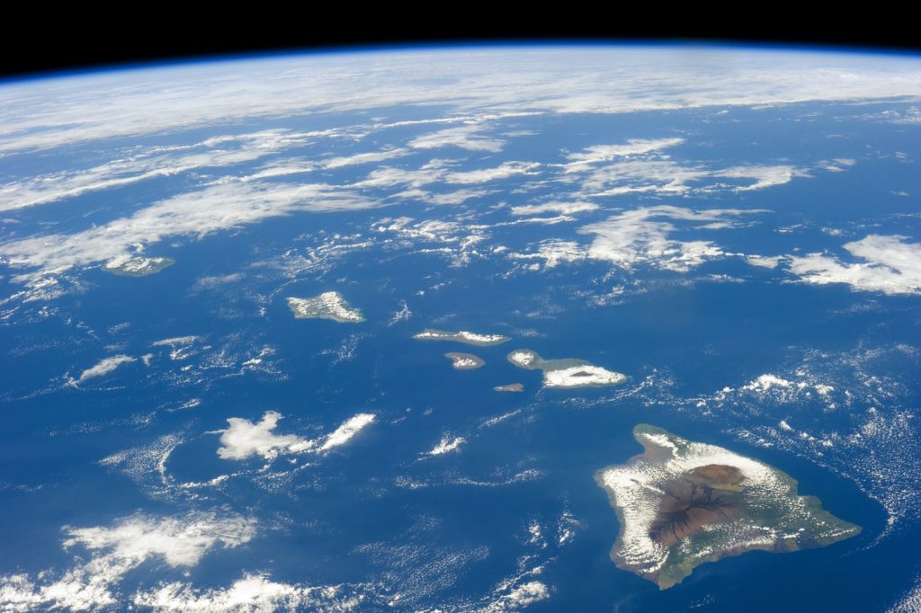
HONOLULU, September 12 — The Pacific is running hot, and the islands in its path know what that means. An official U.S. government website warns that the 2026 El Niño is forecast to bring severe climate hazards across Hawaiʻi and the U.S.-Affiliated Pacific Islands, a sprawl of jurisdictions scattered over millions of square miles of ocean.
That list runs from the Commonwealth of the Northern Mariana Islands and the unincorporated territories of American Sāmoa, Guam and the Pacific Remote Islands, through the Freely Associated States — the Federated States of Micronesia, the Republic of the Marshall Islands and the Republic of Palau — to the state of Hawaiʻi itself. The region sits near the center of the large-scale ocean-atmosphere interactions that drive El Niño, which is why it absorbs some of the most pronounced impacts of any part of the United States during these events.
A very strong El Niño shifts the odds of particular outcomes rather than guaranteeing them — and the odds this year are ugly.
A season already off the rails
This pattern is not theoretical. It is unfolding right now. The Central Pacific hurricane season is running well above normal.
Hurricane Lala nearly made a historical direct hit on the Big Island and ranks as Hawaiʻi’s third-wettest tropical cyclone on record. Earlier in the year, Super Typhoons Sinlaku and Bavi struck CNMI and Guam only 83 days apart, leaving residents without water for weeks and without power for nearly two months.
Initial damages were estimated at $1.5 billion, and the biosecurity costs are still coming into focus. The mechanism behind all of it is well understood. During El Niño, weakened trade winds and a warmer central and eastern Pacific basin shift storm-forming conditions eastward.
Storms become more likely to form and track over the USAPI rather than primarily impacting Asia. Guam, CNMI, FSM and Hawaiʻi typically see increased tropical cyclone risk.
Palau typically sees reduced risk as formation shifts north and east of it. Conditions around American Sāmoa are less consistent.
Drought is the slow hazard
Extended drought typically follows the peak of the El Niño cycle, roughly September through March, though timing and severity vary by island and by whether the event is an Eastern-Pacific or Central-Pacific type. For Guam, Saipan and Chuuk, the sharpest historical drought signal has typically arrived in the year after onset rather than during it — suggesting the most acute risk for those islands may fall in early-to-mid 2027. Atoll islands face a more acute water-security risk than high volcanic islands.
Freshwater there exists as a thin lens floating on seawater, often only a few meters thick, and small islands can lose their freshwater lens entirely during a severe drought. Forecasters caution that the El Niño–typhoon relationship is not deterministic.
The 2023 El Niño produced an unusually inactive Western Pacific typhoon season because other ocean-temperature patterns temporarily overrode the usual signal. Storm tracks also tend to become less predictable during El Niño years, so seasonal outlooks describe overall activity levels rather than where any individual storm will make landfall. The region has fewer downscaled climate products and tools than the continental U.S., making it difficult to sharpen the odds more pointedly.
What to watch next: whether the drought signal lands on schedule for Guam, Saipan and Chuuk in early-to-mid 2027, and whether the coral bleaching and invasive species spread that accompany these events follow the same track.




